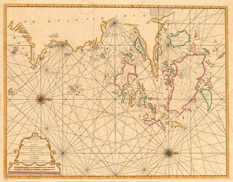
From the Secret Atlas! Nice example of this extremely rare sea chart of the area around Ningbo, Zhoushan and Mount Putuo (Powto) in the Zheijang Province of China, at the mouth of the Yangtze Delta, just south of Shanghai, from the Dutch East India'...
Canton, Macao & Hong Kong etc. -- The VOC Secret Atlas The chart was made for and used by the VOC (Dutch East India Company) for navigation and trading, with a compass rose with rhumb lines, depth indications and other relevant navigational...
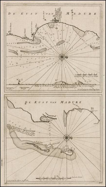
Nice example of this detailed pair of maps of the Madura Coast, from the Dutch East India' Company's Secret Atlas. The chart is oriented with west at the top and shows the areas around the Dutch trading houses ast Warande Patnam and de Groote Kerke...
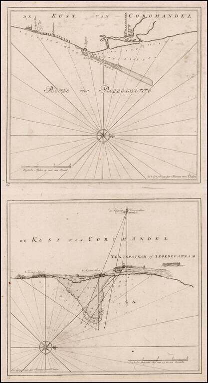
Nice example of this detailed pair of maps of the Coromandel Coast, from the Dutch East India Company's, Secret Atlas. The chart is oriented with west at the top and shows the areas around the Dutch trading houses, etc. The map includes a latitude...
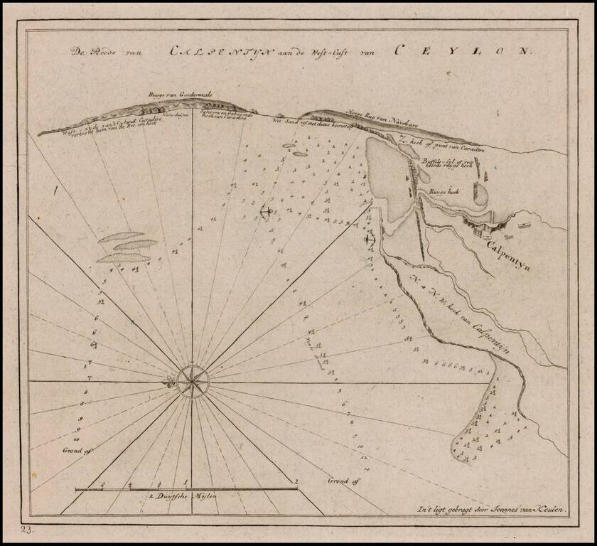
Nice example of this fine plan of the Sri Lankan Coastline, from the Dutch East India Company's Secret Atlas. The chart is oriented with east at the top and shows the areas around the Dutch trading houses, etc. The map includes a latitude scale,...
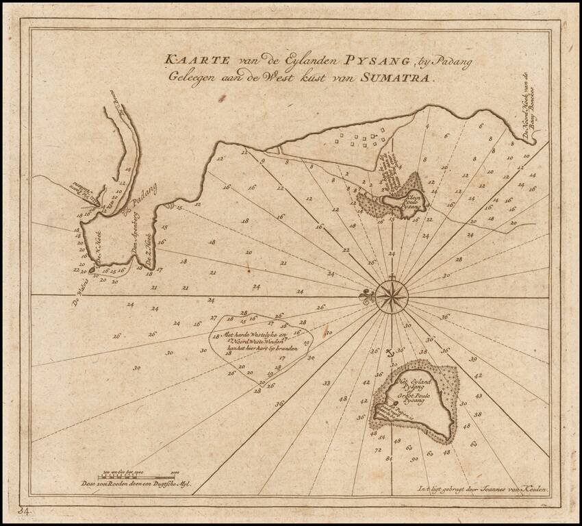
Finely detailed sea chart of Padang and vicinity on the west coast of Sumatra, from Van Keulen's "secret atlas." The chart shows the coast of Padang, and the neighboring islands, including Pulau Pisang. The map notes numerous depth soundings, reefs...
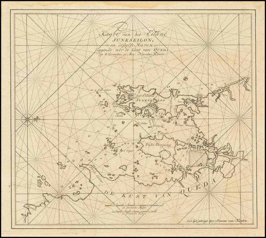
Map of Phuket, Thailand from the Famed Part Six of the Van Keulen Zee-Fakkel - the Secret Atlas of the VOC. A highly important chart, and the first printed map dedicated to Phuket and Pha Nang Bay. The towns of Phuket ("Puquet") and Patong ("Putom")...
![[False Bay] In de Baay Falso](/map/small/61861.jpg)
False Bay / Cape Town, South Africa Rare chart of False Bay, which appeared in the so-called VOC Secret Atlas. The map shows "Post-huys", the signal blockhouse built as an observation post controlling False Bay and which was completed in 1673, a year...