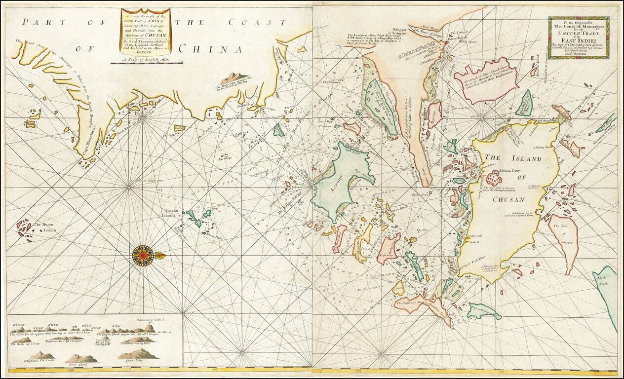
Rare early English sea chart of China's Zhejiang Province, which appeared in an early edition of the The English Pilot: Third Book. The map shows the area around Zhoushan, including Ningbo, Hangzhou and the area just to the south of Shanghai. This...
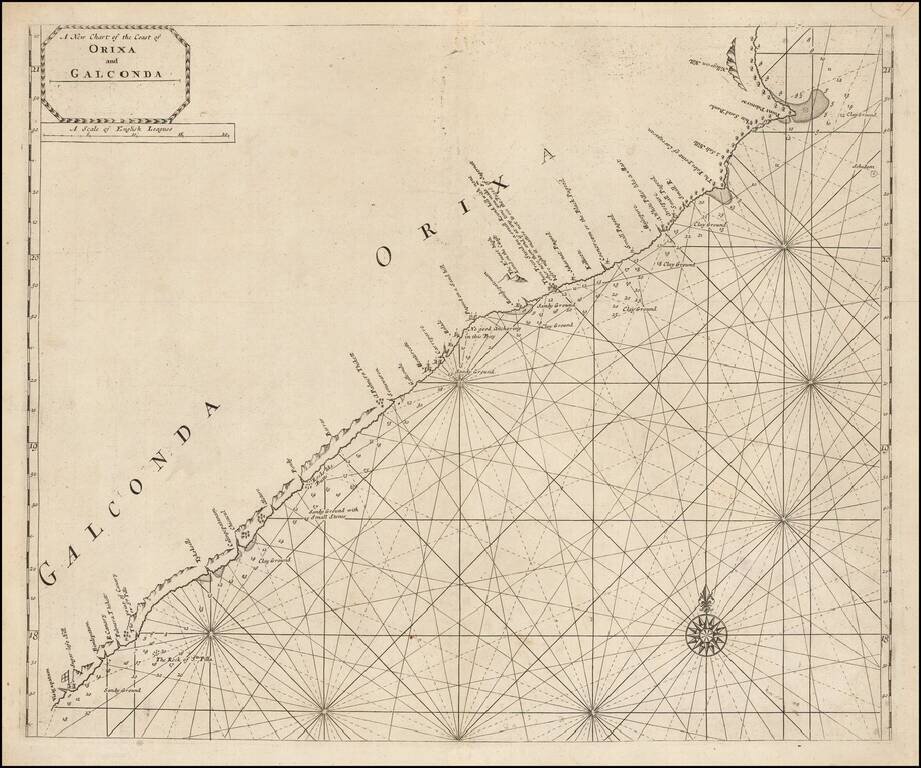
Scarce engraved sea chart of the coast of India, northeast from Vizagapatam (Visigapatam on the map). The map includes details along the coast that suggest the firsthand surveying that went into its production. Soundings are given from harbor to...
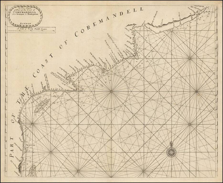
Scarce engraved sea chart of the Coromandel coast in southeast India covering the state of Andhra Pradesh from Bheemunipatnam (Bimlepatnam) near Visakhapatnam to Armegon. The map includes details along the coast that suggest the firsthand surveying...
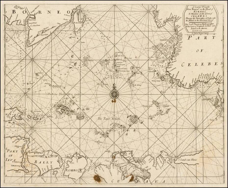
Rare early example of this working English sea chart of part of Indondesia, extending from the northwest corner of Borneo near Banjarmasin, to Java and Bali in the outhwest, "t Land van Floris" in the southeast, and Celebes in the northeast. The chart...
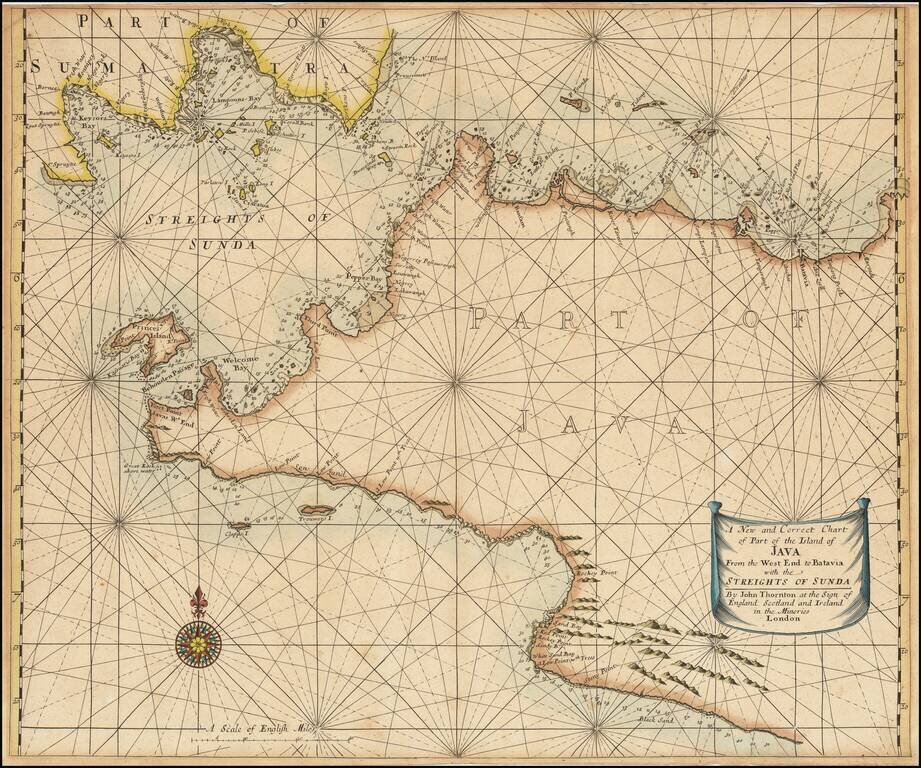
Scarce engraved sea chart of the coast of Western Java and the southern tip of Sumatra, published by John Thornton. The map includes details along the coast that suggest the firsthand surveying that went into its production. Soundings are given from...
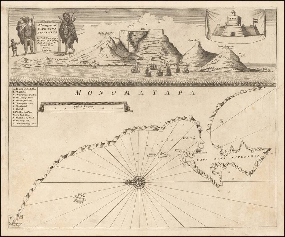
Rare 1711 edition of John Thornton's engraved chart of the Cape of Good Hope, published posthumously by his brother, Samuel Thornton. The bottom image comprises a sea cart from Table Bay to False Bay with superimposed coastal profiles. Above that is...
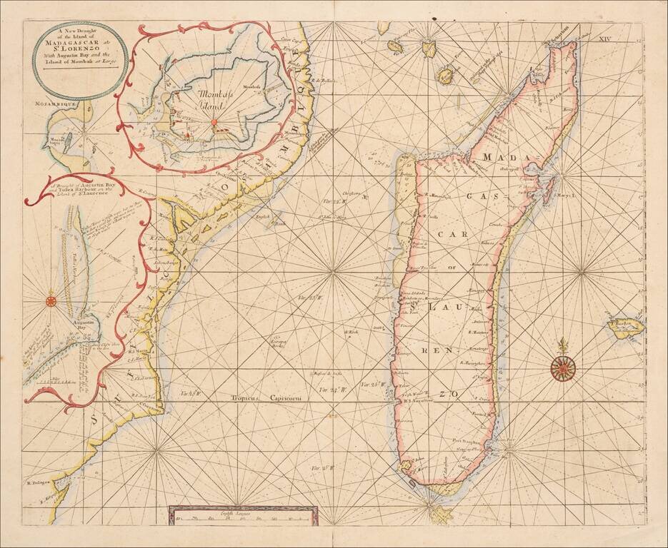
Scarce engraved sea chart of the coast of coast of Mozambique and the island of Madagascar with three insets of important ports north of Mozambique. This is an important map for Kenya as well, as it shows "Mombass Island", now Mombasa, with a...
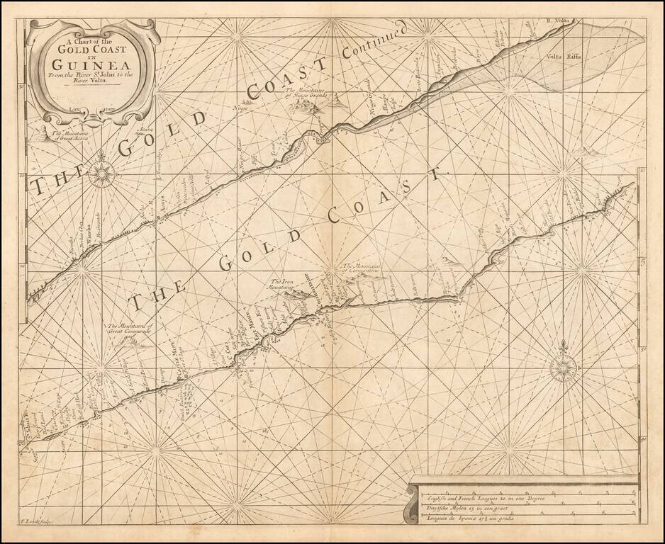
Rare English sea chart of the Gold Coast, published by Samuel Thornton. The chart includes 2 sections of the West African Coastline, along the Cape Coast of Ghana. A number of Western settlements are noted, including: Dutch Factory at Fort St. Jago...