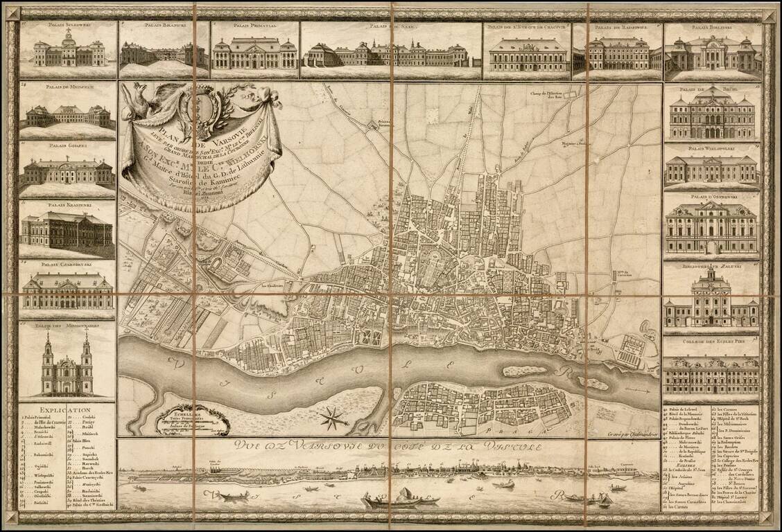
Fine example of the earliest obtainable city plan of Warsaw, engraved by Chalmandrier for Giovanni Antonio Rizzi Zannoni in 1772. Rizzi Zannoni's plan is based upon the 4-sheet plan of Warsaw by Pierre Ricaud de Tirregaille, entitled Plan de la ville...
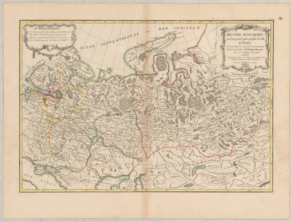
Detailed map of Russia, extending from Scandinavia and Baltics to nearly the Pacific. Shows forests, rivers, towns, mtns, lakes, etc. 2 decorative cartouches. The map is based upon the rescently completely Atlas of Russia, for which the famous French...
![L'Italie divisee en ses differens Etats… [2 sheet map]](/map/small/66173.jpg)
Attractive pair of maps Italy, Corsica, Sardinia, Sicily and Malta, showing extraordinary details. Large decorative title carouche.
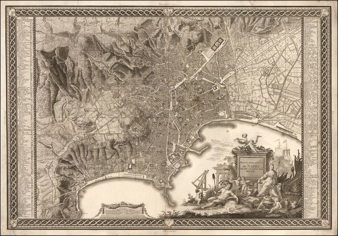
Nice example of Rizzi Zannoni's fine early Plan of Naples and vicinity, engraved by Giuseppe Guerra and published in Naples in 1790. The map is a marvelous blend of engraving artistry and topographical detail, capturing the rugged topography...
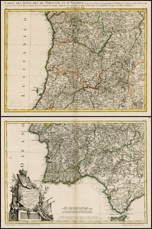
Scarce double page map of Portugal in original color, from Rizzi-Zannoni, the Royal Geographer of France. One of the most highly detailed large format maps of Portugal published in a commercial atlas during the period. Includes exceptional detail,...
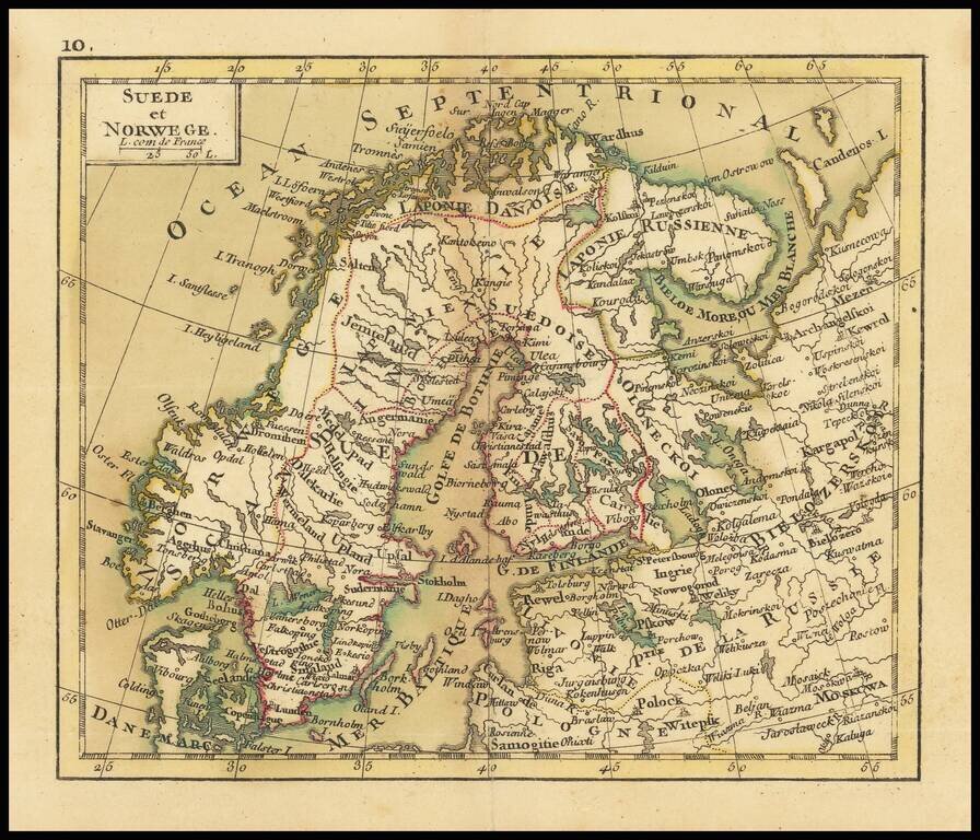
Small engraved map of Scandinavia and northwestern Russia. The map is scarce, this being the first time we have had it.