Nicholas de Fer (1646-1720) was the son of a map seller, Antoine de Fer, and grew to be one of the most well-known mapmakers in France in the seventeenth century. He was apprenticed at twelve years old to Louis Spirinx, an engraver. When his father died in 1673, Nicholas helped his mother run the business until 1687, when he became the sole proprietor.
His earliest known work is a map of the Canal of Languedoc in 1669, while some of his earliest engravings are in the revised edition of Methode pour Apprendre Facilement la Geographie (1685). In 1697, he published his first world atlas. Perhaps his most famous map is his wall map of America, published in 1698, with its celebrated beaver scene (engraved by Hendrick van Loon, designed by Nicolas Guerard). After his death in 1720, the business passed to his sons-in-law, Guillaume Danet and Jacques-Francois Benard.
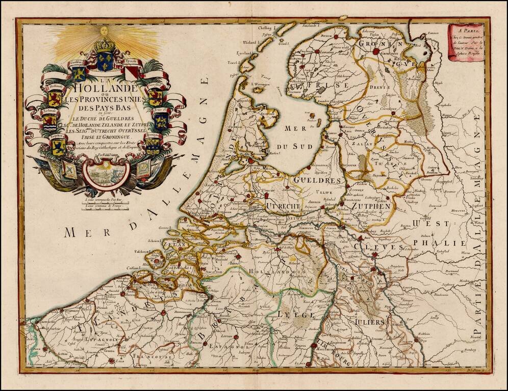
Scarce map of the 7 Provinces published in Paris by Danet. Includes 7 coats of arms in the title cartouche.
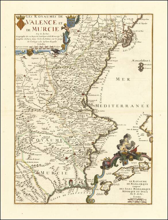
Detailed map of Valencia and Murcia, with a large decorative inset of the Balearic Islands. Includes 2 coats of arms in the title cartouche. Includes excellent detail, including the inset of the Balearic islands, which shows many place names and a...
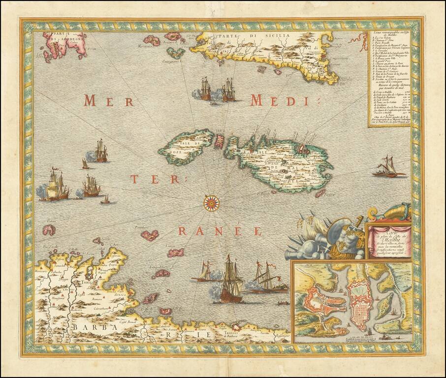
Fine example of Danet's rare map of Malta, with a plan of the harbor and fortifications of Valletta, on the Island of Malta. In upper right corner, there is a key locating the principal places (most of which are fortified) on the map. A number of...
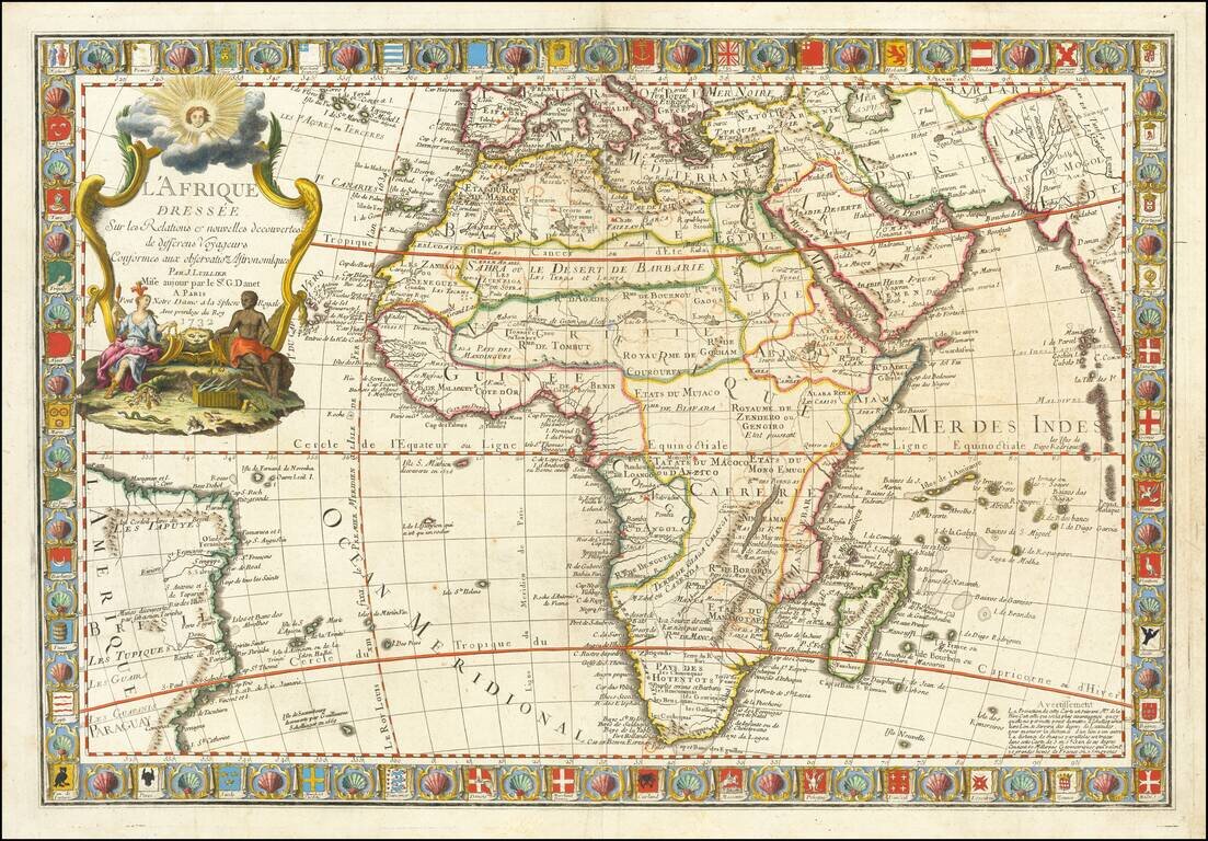
Fine Map of Africa with Distinctive, Decorative Border Striking example of the 1732 edition of this ornate map of Africa, published by Guillaume Danet in Paris. A defining feature of the map is the border, which is filled with dozens of maritime...