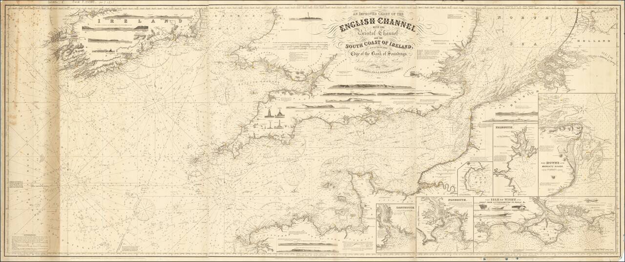
Rare working navigational sea chart, published in London by J.S. Hobbs. The map covers the English Channel, Bristol Channel and contiguous coasts of Southern Ireland, Southern England and a portion of the coast of France. Includes a number of profile...