logo

Patrick Browne

Patrick Browne


1

1755 - A New Map of Jamaica. In which the Several Towns, Forts, and Settlements are Accurately laid down as well as ye situations & depts of yet most noted Harbours & Anchoring Places, with the limits & boundarys . . . Made by Mr. Shefield and others from the Y

  • $14.99

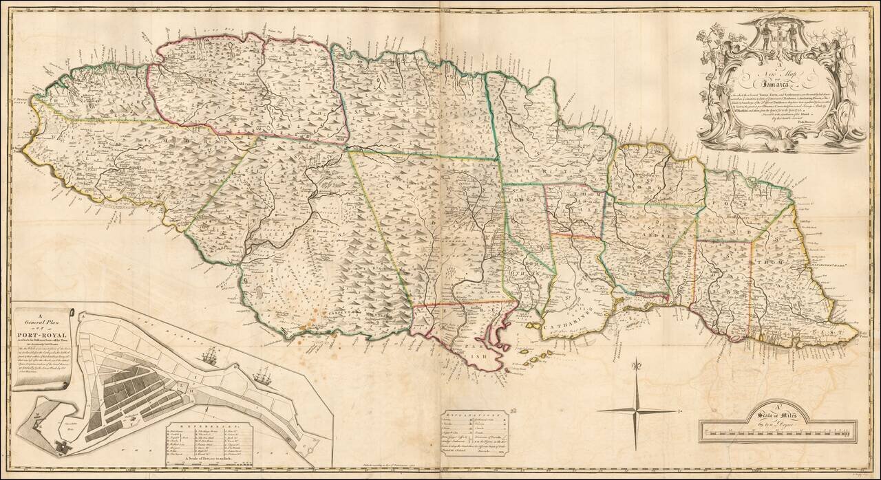
The true first state of the first large format Map of Jamaica. Fine 2-sheet map of Jamaica, published in London in 1755, engraved by J. Bayly. The present example is the first state of the "The first large-scale map of Jamaica." This large, dramatic...