logo

Department of Lands and Works

Department of Lands and Works


1

1897 - Map of the West Division of Kootenay District and a portion of Lillooet, Yale & East Kootenay, B. C. Compiled by Direction of The Honourable G.B. Martin Chief Commissioner of Lands and Works . . . 1897 (with) Map of the Klondyke, Cassiar, Omineca and Ca

  • $14.99

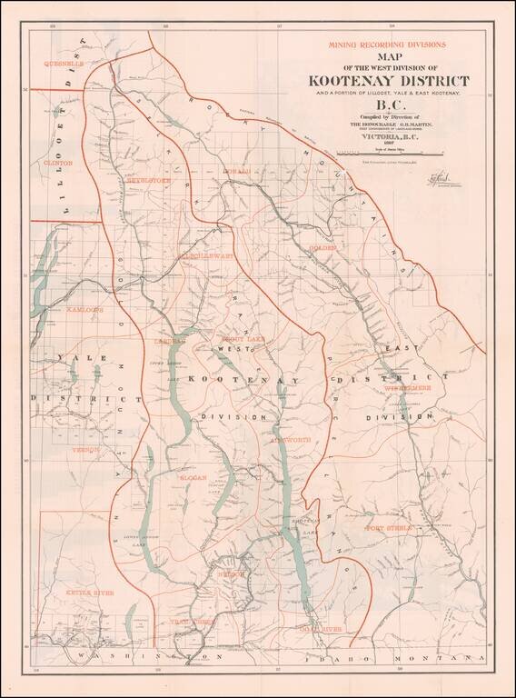
British Columbia's Progress Illustrated Graphically (and a Great Map of the West Kootenay District) Fine large Canadian government publication, illustrating the West Kootenay Mining District on the front side of the map and the Klondyke, Cassiar,...


2

1906 - Map of the South-Western Part of British Columbia Compiled and Drawn By Direction of the Honorable R.F. Green, Chief Commissioner of Lands and Works Victoria, B.C. 1906

  • $21.99

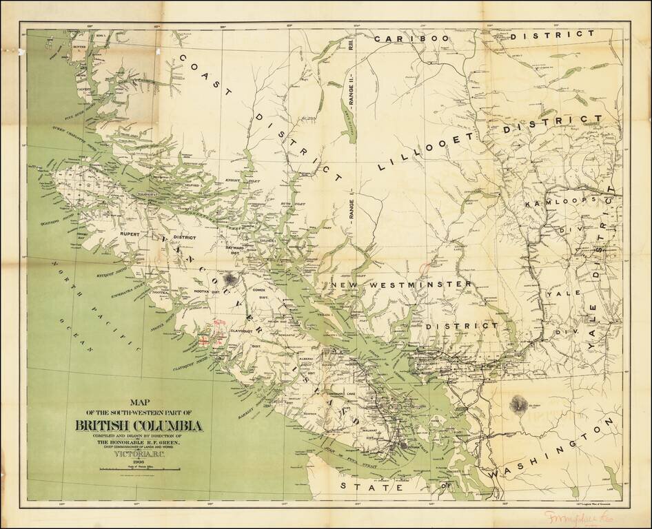
With Annotations By An Early Logging Concern? Important early Map of Southwestern British Columbia, published by the Department of Lands and Works. The map which depicts the relative locations of various Land Districts and Divisions in south-west...