Nicholas de Fer (1646-1720) was the son of a map seller, Antoine de Fer, and grew to be one of the most well-known mapmakers in France in the seventeenth century. He was apprenticed at twelve years old to Louis Spirinx, an engraver. When his father died in 1673, Nicholas helped his mother run the business until 1687, when he became the sole proprietor.
His earliest known work is a map of the Canal of Languedoc in 1669, while some of his earliest engravings are in the revised edition of Methode pour Apprendre Facilement la Geographie (1685). In 1697, he published his first world atlas. Perhaps his most famous map is his wall map of America, published in 1698, with its celebrated beaver scene (engraved by Hendrick van Loon, designed by Nicolas Guerard). After his death in 1720, the business passed to his sons-in-law, Guillaume Danet and Jacques-Francois Benard.
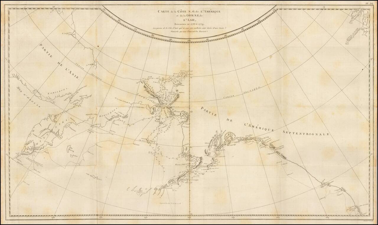
Finely engraved map of the North Pacific and contiguous coastlines of Alaska and Russia, published in the first French edition of the official account of James Cook's Third Voyage. The present map is of the utmost importance in the cartographic...
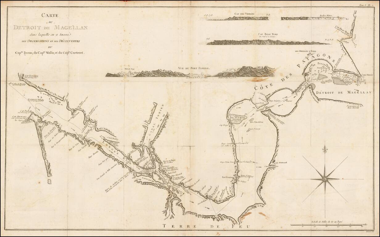
Rare chart of the Straits of Magellan from the Relation des Voyages Entrepris par Ordre de sa Majeste Britannique, the French edition of the official account of the first voyage of James Cook. The chart details the Straits of Magellan and the truly...
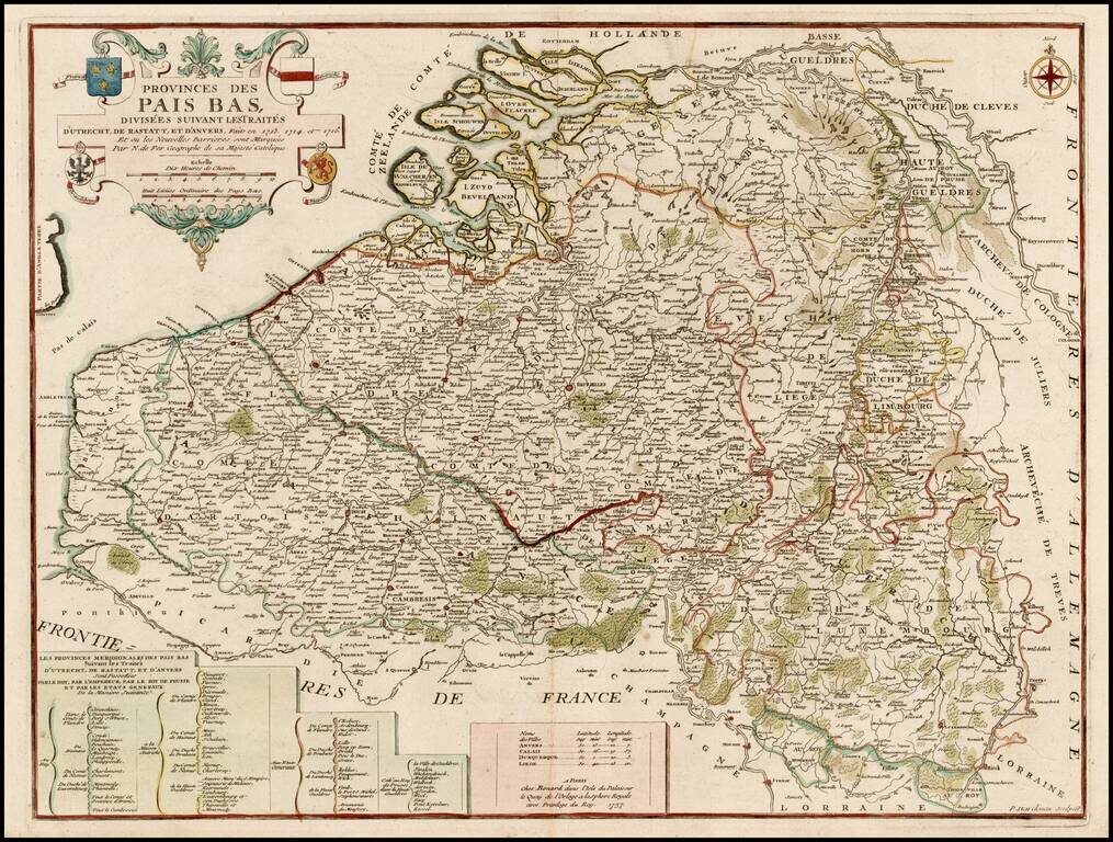
Scarce Benard edition of this detailed map of the Low Countries, from Zeland and Brabant to Luxembourg and Artois. The map includes the coats of arms of France, Austria, Brandenburg and the States General.