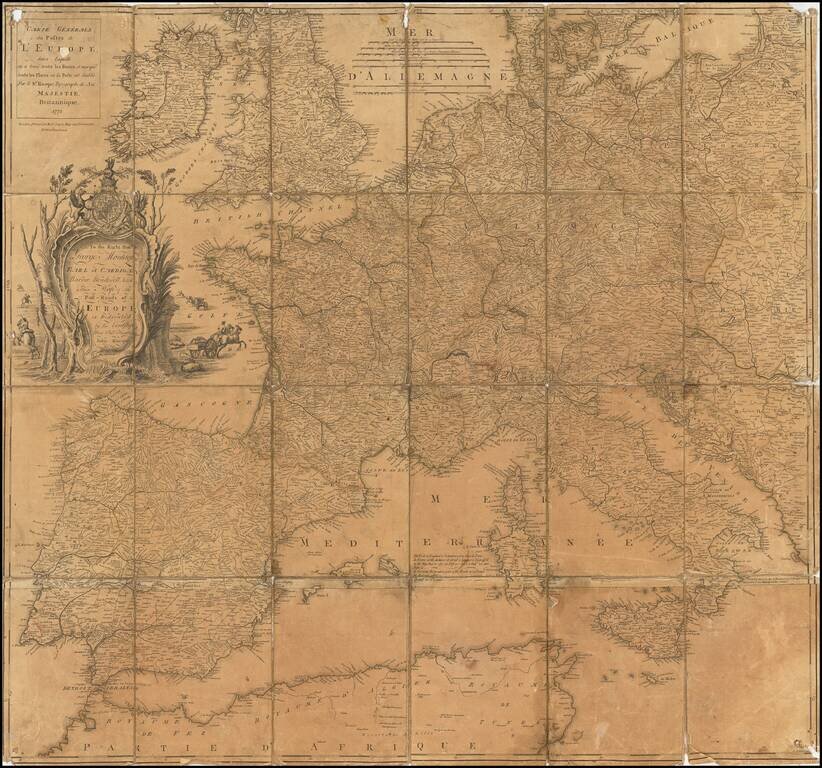
Somewhat warn example of John Rocque's map of the Post Roads of Europe, published by Robert Sayer in London, in 1773. The first state of the map appeared in 1758. The present map is the second printing in 1771, with the Sayer imprint, replacing the...
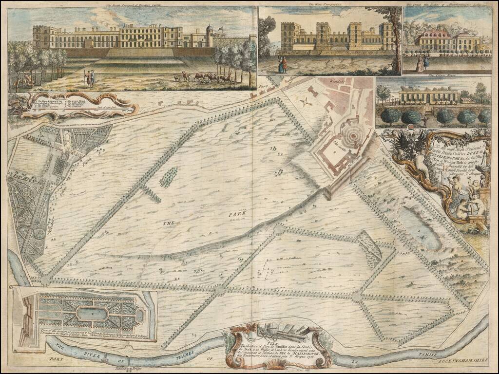
Rare early plan of Windsor Park, engraved by John Rocque. The Plan is oriented with west at the top and includes inset views of the Green House, The Duke of Marlborough's Lodge, and two views of Windsor Castle. Published in 1738, this is among...