Gilles Robert de Vaugondy (1688-1766) was the head of a leading family of geographers in eighteenth century France. Gilles got his start when he jointly inherited the shop of Pierre-Moullart Sanson, grandson of the famous geographer Nicholas Sanson. The inheritance included the business, its stock of plates, and a roller press. In 1760 Gilles became geographer to King Louis XV. His son, Didier Robert de Vaugondy (ca. 1723-1786), was also a geographer and the two worked together. They were known for their exactitude and depth of research. In 1757, they produced the Atlas Universel, considered an authority for many years.
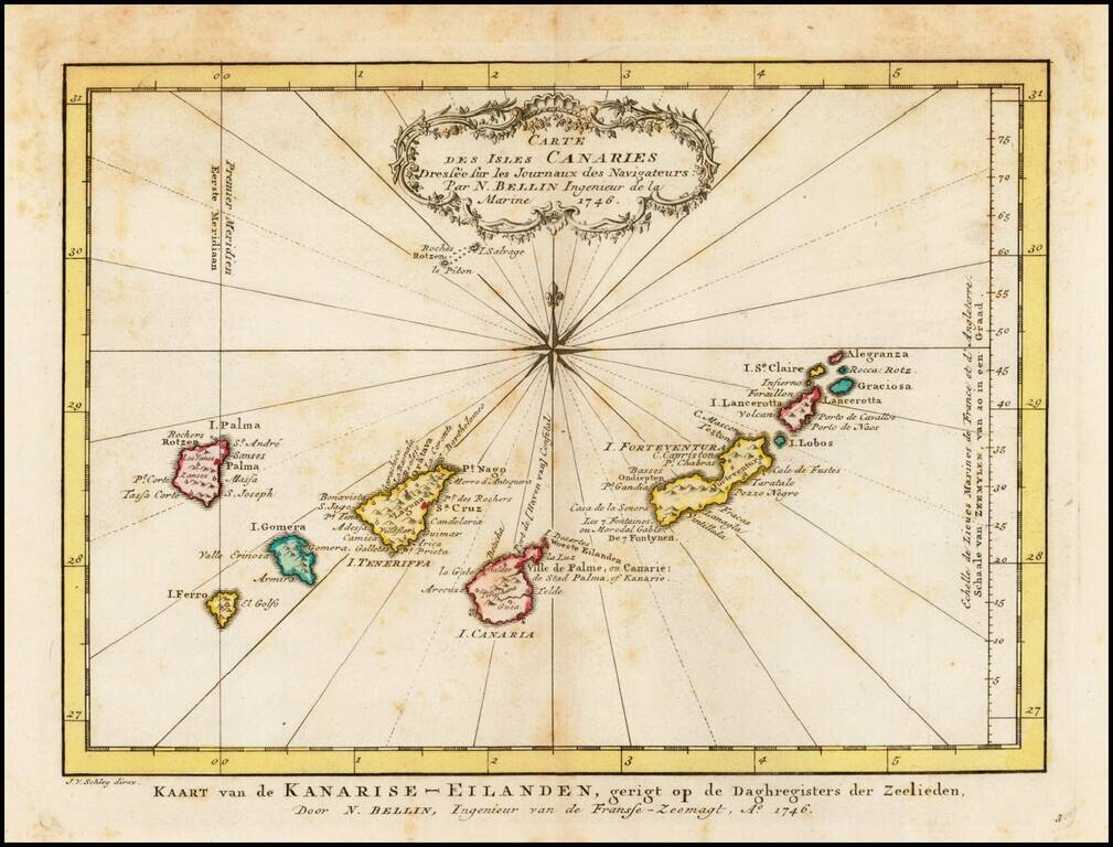
Detailed map of the Canary Islands, originally issued by Bellin and reissued in Dutch in 1770. Nice Cartouche and Compass Rose.
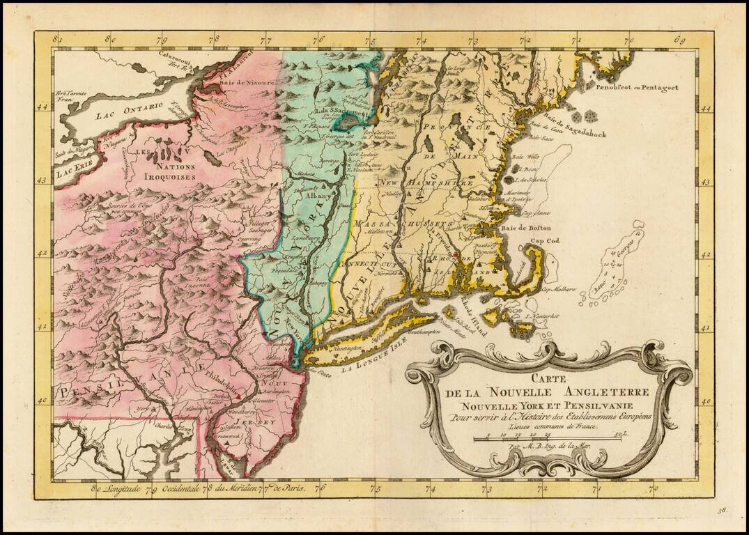
An excellent early map of the region bounded by New England, Lake Ontario and the northern Chesapeake River, centered on New York and Connecticut from a Dutch edition of Bellin's Histoire Generale des Voyages. Shows towns, roads, mountains, rivers,...
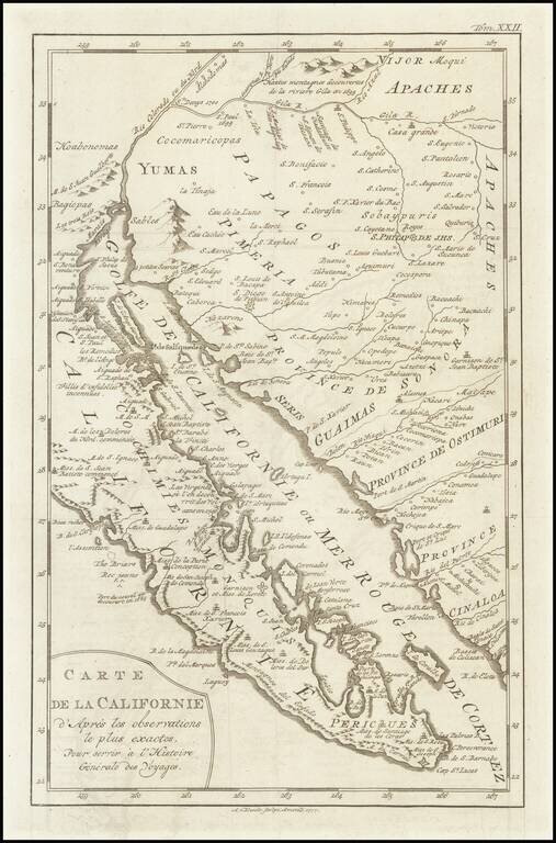
A scarce map of Baja California, northwestern Mexico, and southern Arizona. The map is detailed, showing many settlements, mountain ranges, islands, missions, and much more. California is shown as a peninsula. The California as an Island in its most...

Rare Dutch Edition of Didier Robert De Vaugondy's Comparative Cartographic Gem -- The Final De Vaugondy Map In The Greatest Cartographic Debate of the 18th Century Didier Robert De Vaugondy's Nouveau System Geographique . . . represents the final...
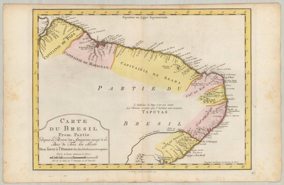
Detailed regional map of the coast of Brazil, from Maracana to Baye de Tous les Saints. Covers Capitanie De Maragnan, Seara, Rio Grande, Paraiba, D'Olinde and Sergipe. Includes a decorative title cartouche. Based upon an earlier map by Nicholas Bellin.
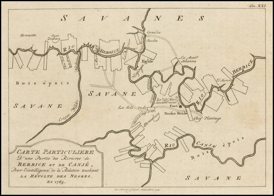
Scarce plan of Berbice, Surinam, illustrating the town at the time of the Slave Revolt of 1763. The Berbice Slave Revolt began in February 1763 and lasted into 1764. The uprising began on Plantation Magdalenenberg on the Canje River in Berbice. The...
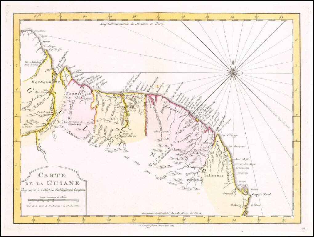
Detailed regional map, extening from Amacahra and Riv. Essequebo to Cap de Nord and R. Arawari, with a decorative compass rose. Scarce Dutch map, based upon an earlier map by Nicholas Bellin.