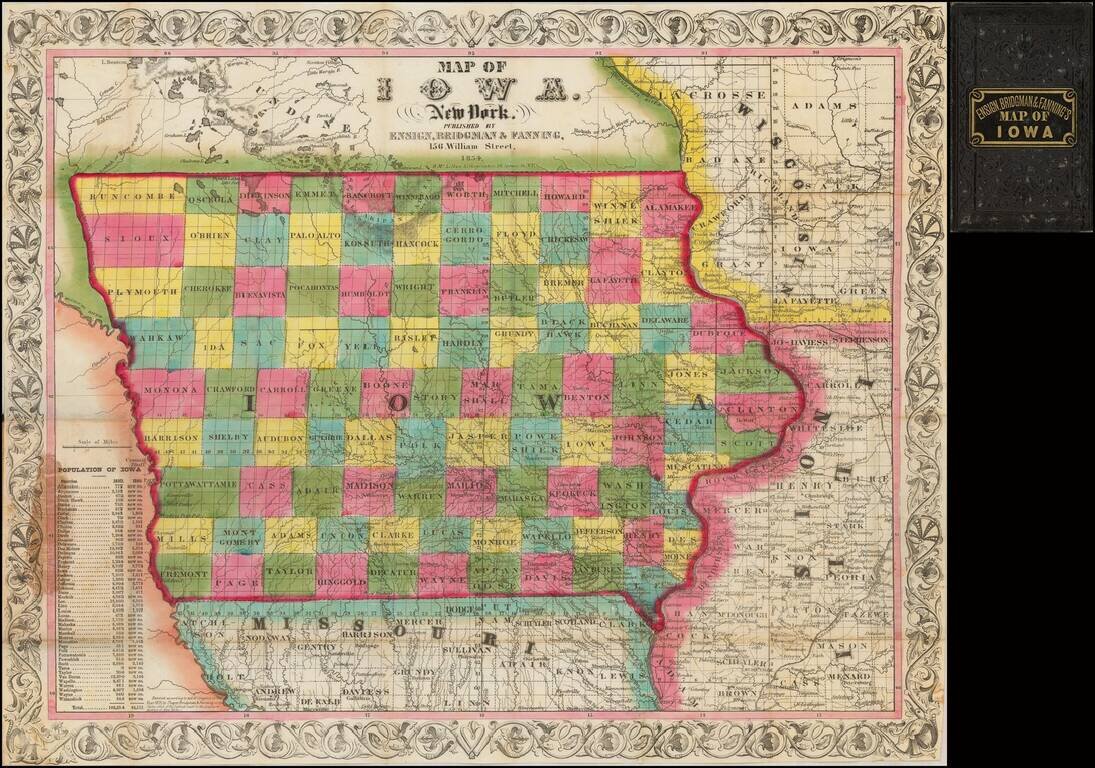
A Stunning Early Map of Iowa
Fine early map of Iowa during its initial period of rapid settlement, showing the land office locations, a table of population by county in 1840 and 1850, and the settled areas of adjoining states.
Rare first...
antiquemaps.ru is sale. 12,000+ superb pieces of vintage collectible printable 300dpi maps - total 300GB high resolution rare and antique old map archive!
antiquemaps.ru website use cookies, local storage and other similar technologies. This is necessary to ensure the full functionality of our services. Using our services and sites after reading this notice means that you have given your consent to their use in your browser. Click "OK" to confirm your agreement