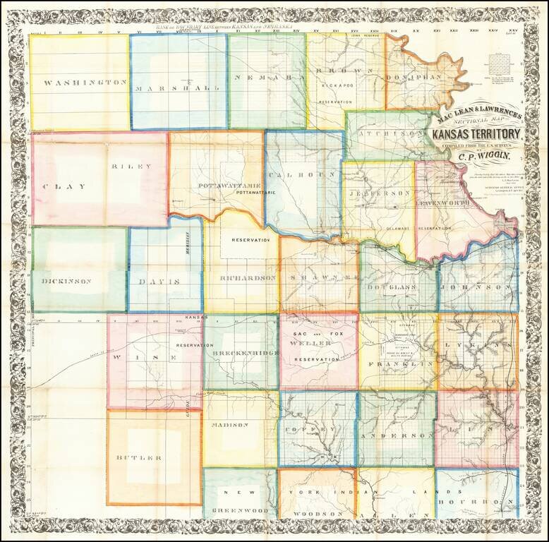
The First Great Map of Kansas Territory
Fine large map of the soon to be "settled part" of Kansas Territory, drawn from the work of C.P. Wiggin. and lithographed by William Schuchman & Bro in Pittsburgh.
The map illustrates the earliest...
antiquemaps.ru is sale. 12,000+ superb pieces of vintage collectible printable 300dpi maps - total 300GB high resolution rare and antique old map archive!
antiquemaps.ru website use cookies, local storage and other similar technologies. This is necessary to ensure the full functionality of our services. Using our services and sites after reading this notice means that you have given your consent to their use in your browser. Click "OK" to confirm your agreement